Streamlined property risk assessment for brokers and insurance companies with comprehensive data insights and remote inspection capabilities.
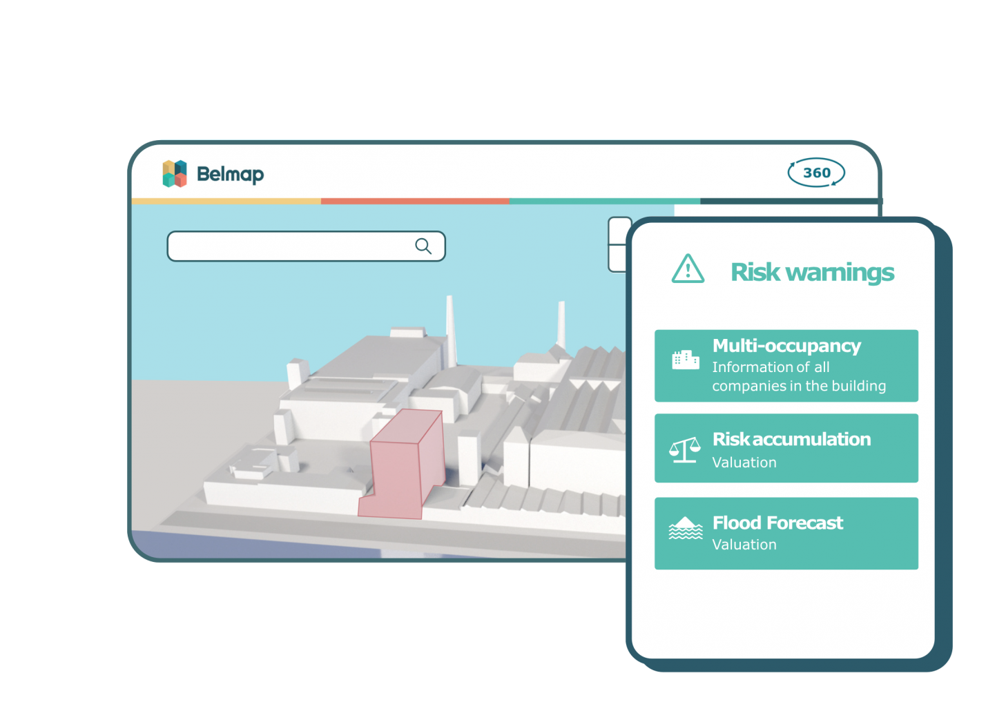
Brokers and insurance companies can access Belmap data through the Belmap 360 Risk portal.
- All data on potential risks are collected through one interface.
- Visualize the characteristics of each property.
- Discover the activities taking place there and in its surroundings.
- Analyze the risks associated with the environment.
Draw conclusions with confidence
Thanks to its comprehensive analysis capabilities, you get precise and reliable insights for assessing the risks associated with commercial and industrial business activities. Moreover, Belmap 360 is also a valuable tool for ESG reporting and sustainability analysis.
How insurers use Belmap 360 to optimize their risk assessment
 |
Map application provides optimal insight into risks for insurer MS AmlinInsuring corporate real estate is not without risk. Limited and fragmented data and tools are just some of the pitfalls MS Amlin must be on alert for. In cocreation with the insurer, GIM developed a mapping application to capture insurance risks more efficiently, objectively and comprehensively. |
Make our data work for you
and digitize your risk assessment
The most complete
|
Automated
|
Stable identifier
|
User feedback
|


