How much space do paved surfaces take up in (front) gardens and in the public domain? Thanks to the use of artificial intelligence and aerial imagery, you can now find this information in Belmap. Good news for utility companies planning excavations, electric charging station operators and authorities battling flooding and heat stress.
Belmap is the 3D digital twin of our living environment and offers a complete insight into buildings, addresses and related spatial themes in the Benelux. Through the use of artificial intelligence and the smart integration of more than 50 data sources, Belmap provides incomparable insights into reality.
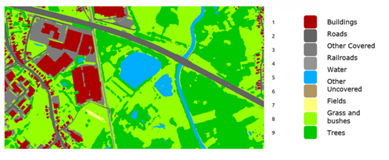
Land cover insights in minute detail thanks to artificial intelligence
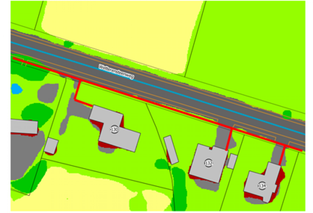
Data scientists at GIM analysed recent aerial imagery with image recognition algorithms. They used these to build a dataset with a complete and up-to-date inventory of land cover for all cadastral plots. The result? A highly accurate inventory of land cover grouped into 9 classes, such as buildings, roads, railroads, gardens, water bodies, trees and so on, based on the latest available orthophotos.
This wealth of information is now available through two new data modules in Belmap:
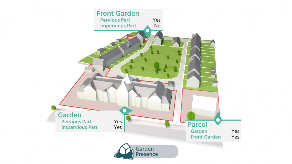
- Garden presence describes for each cadastral plot whether it contains a garden and a front yard and identifies any paved surfaces.
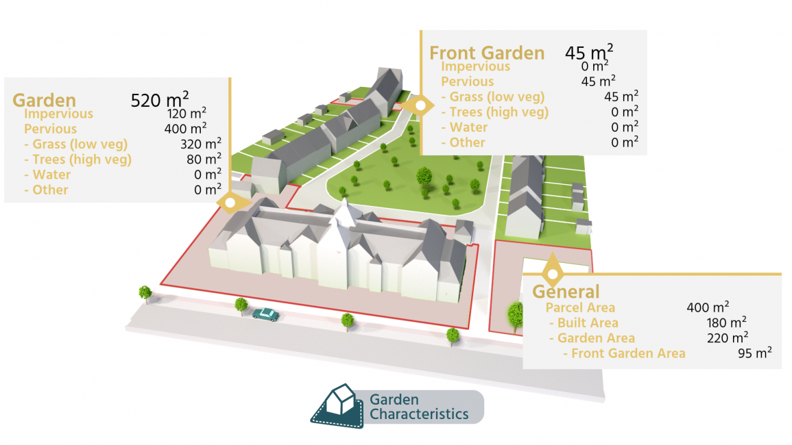
- Garden characteristics describes for each plot the exact area of the gardens, including the proportion of each type of cover, such as grass, trees, bodies of water and paved areas.
Applications
This information provides utility companies with an important asset when planning the installation of new pipelines or cables. Paved areas such as pavements and driveways are a significant cost factor. With this information, they can make a reliable cost estimate for the construction of new-generation networks.
In the coming years, tens of thousands of charging stations will need to be added in this country to enable large-scale electric mobility. For electric charging station network operators, detailed plot information is an important asset in the analysis of the cost and feasibility of new installations.
In the authorities' climate plans, depaving is an important remedy for combating heat stress and flooding. This gives them a tool for assessing how much gain there is to be made from depaving campaigns in their territory.
Garden or just front yard?
Depending on the application, in some cases it is relevant to gather information about front gardens, whereas in other cases, backyards or full gardens are more relevant.
Thanks to clever spatial techniques, Belmap provides a delineation of the front yard for each built-up plot, giving you a more accurate picture of the actual situation.
Do you also see an application for these Belmap data modules? Or are you interested in this full Land Cover layer in raster format? We want to hear from you!