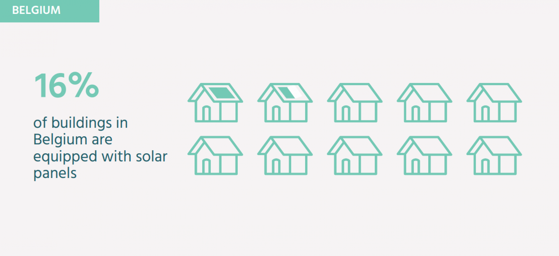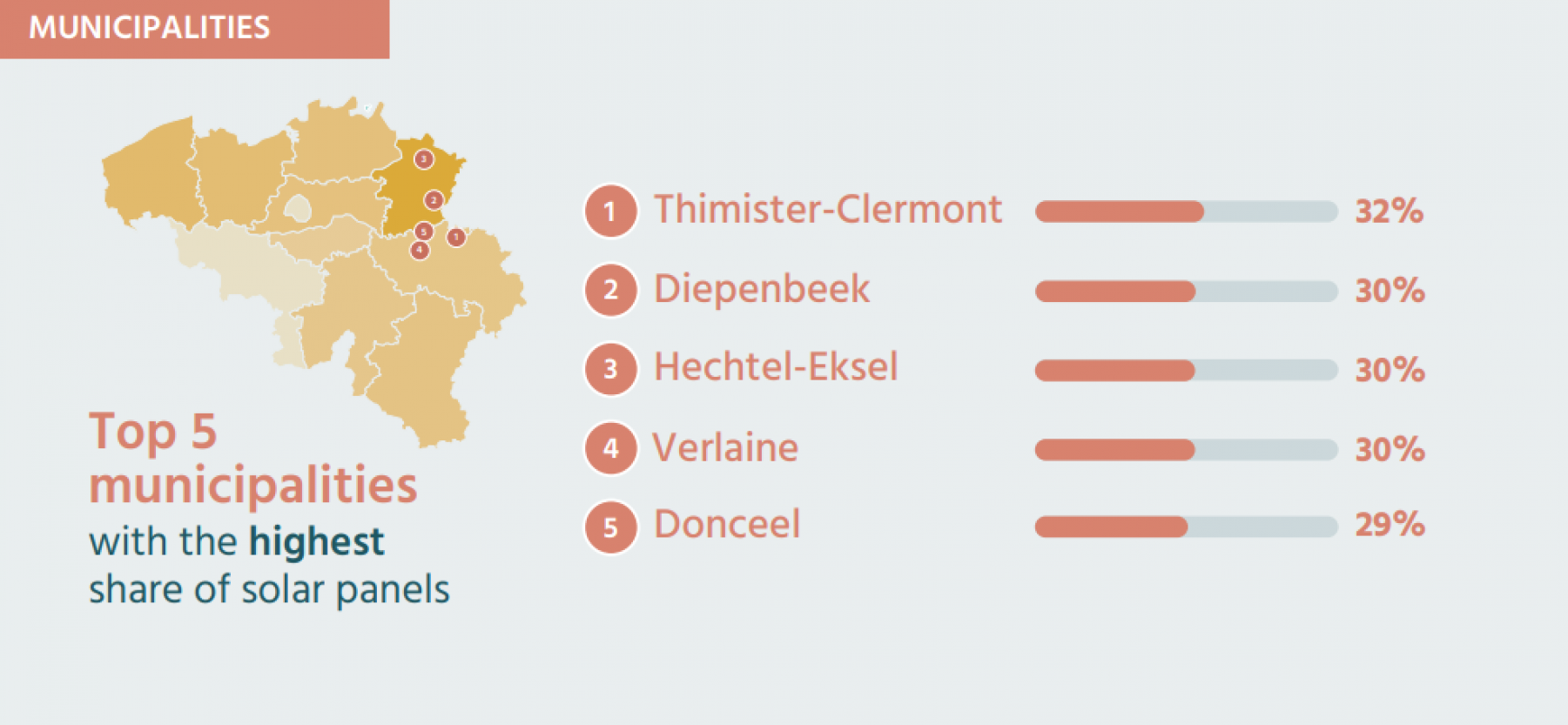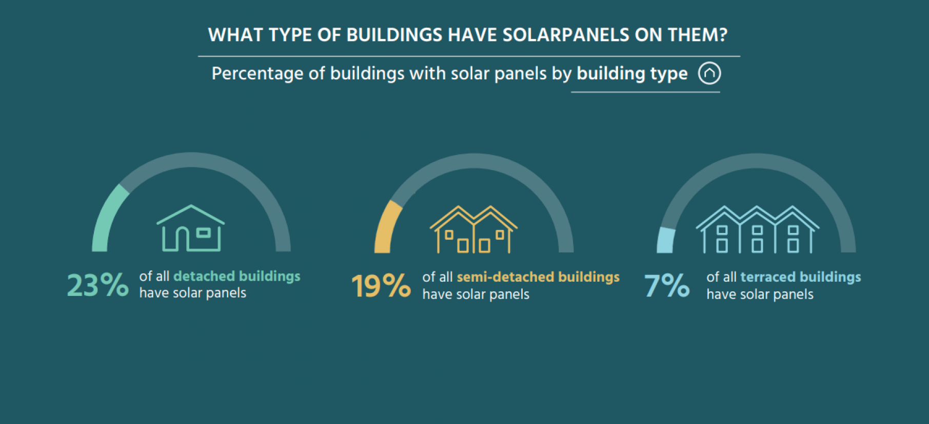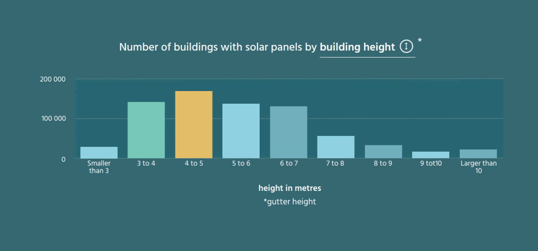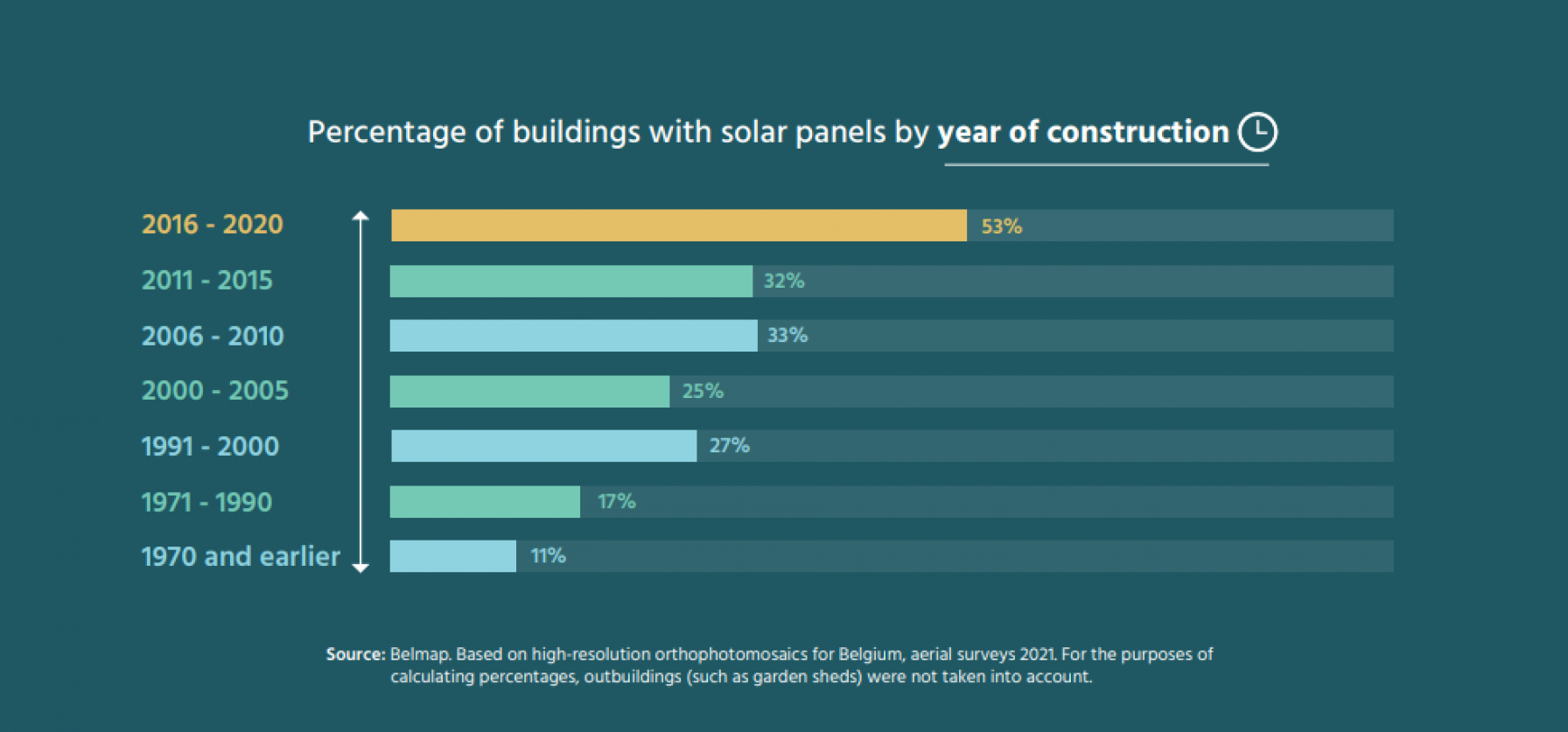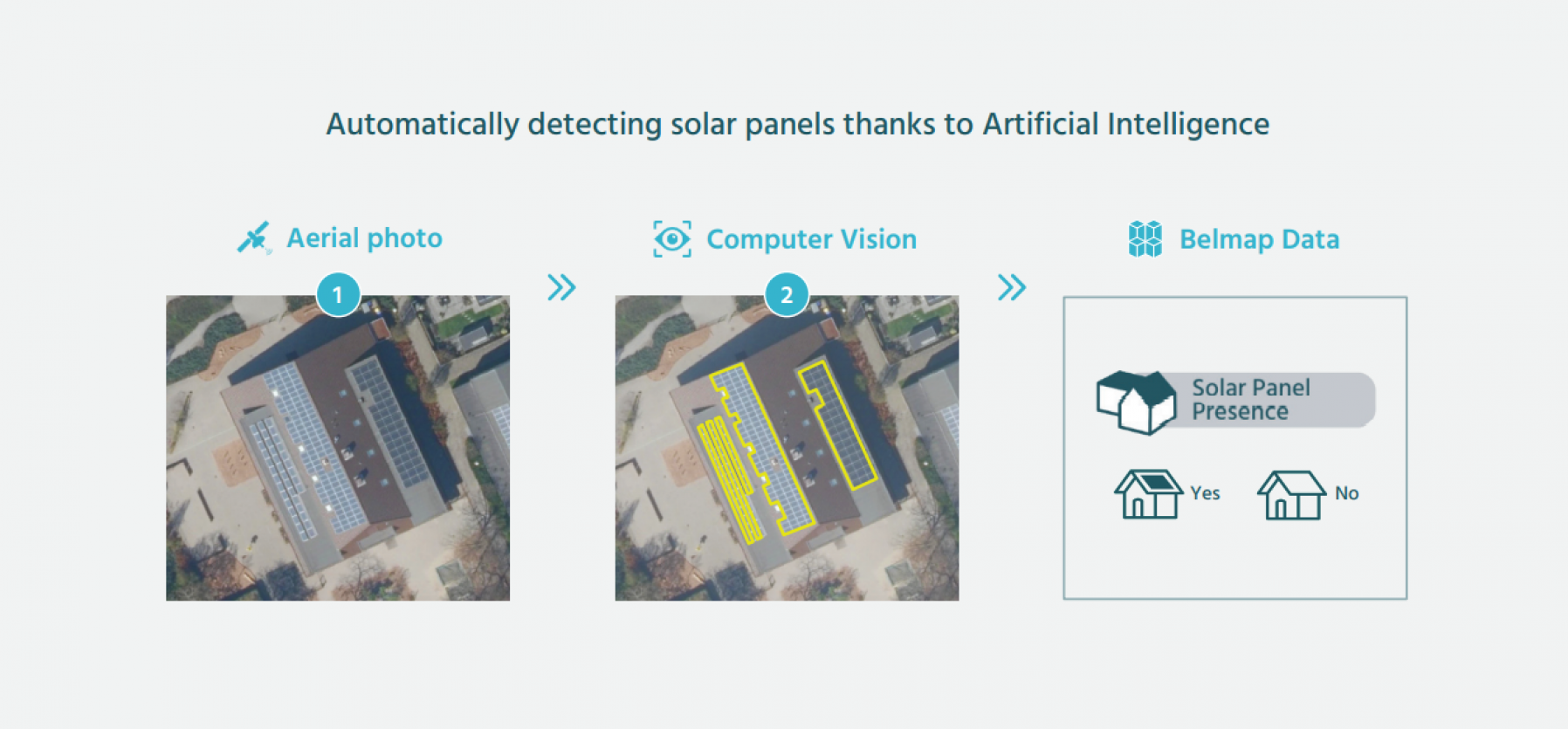
The most recent aerial images for Belgium from 2021 formed the basis for the identification of all the solar installations. GIM's data scientists developed a computer vision model that recognises and maps out solar installations quickly and reliably.