Belmap 360 is the easy-to-use cloud platform that visualizes, combines and analyzes location data from Belmap and other sources. Get clear and reliable insights into any property and its immediate surroundings, both in 2D and 3D.
- Explore property data with ease
- Answer any question in a flash
- Get deep insights into property characteristics.
A single point of access to fine-grained and accurate property data
Stop wasting valuable time manually reviewing, integrating and visualizing data from multiple sources.
Inspect a wealth of quality building, parcel and address information from all over Belgium, the Netherlands and Luxembourg.
Key features of Belmap 360
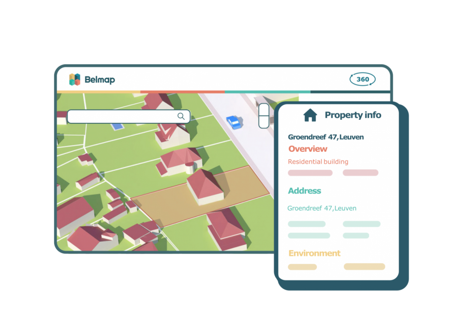
- Display the rich Belmap data directly in one overview: properties of buildings, addresses and parcels – from more than 60 data sources
- Powerful search function with address recognition
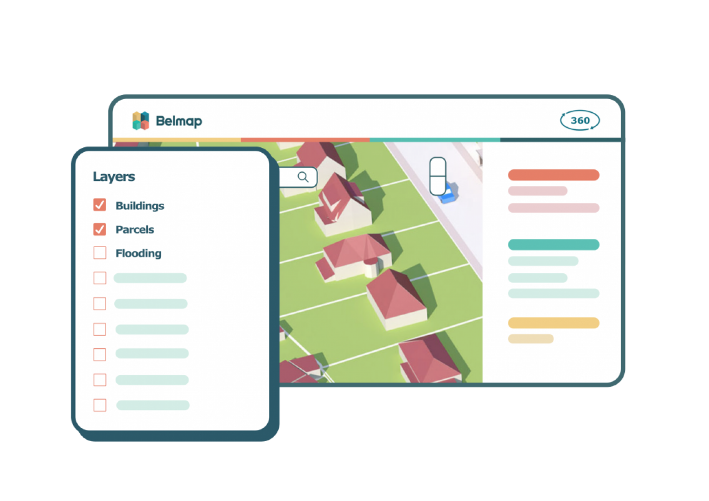
- Show and hide map layers
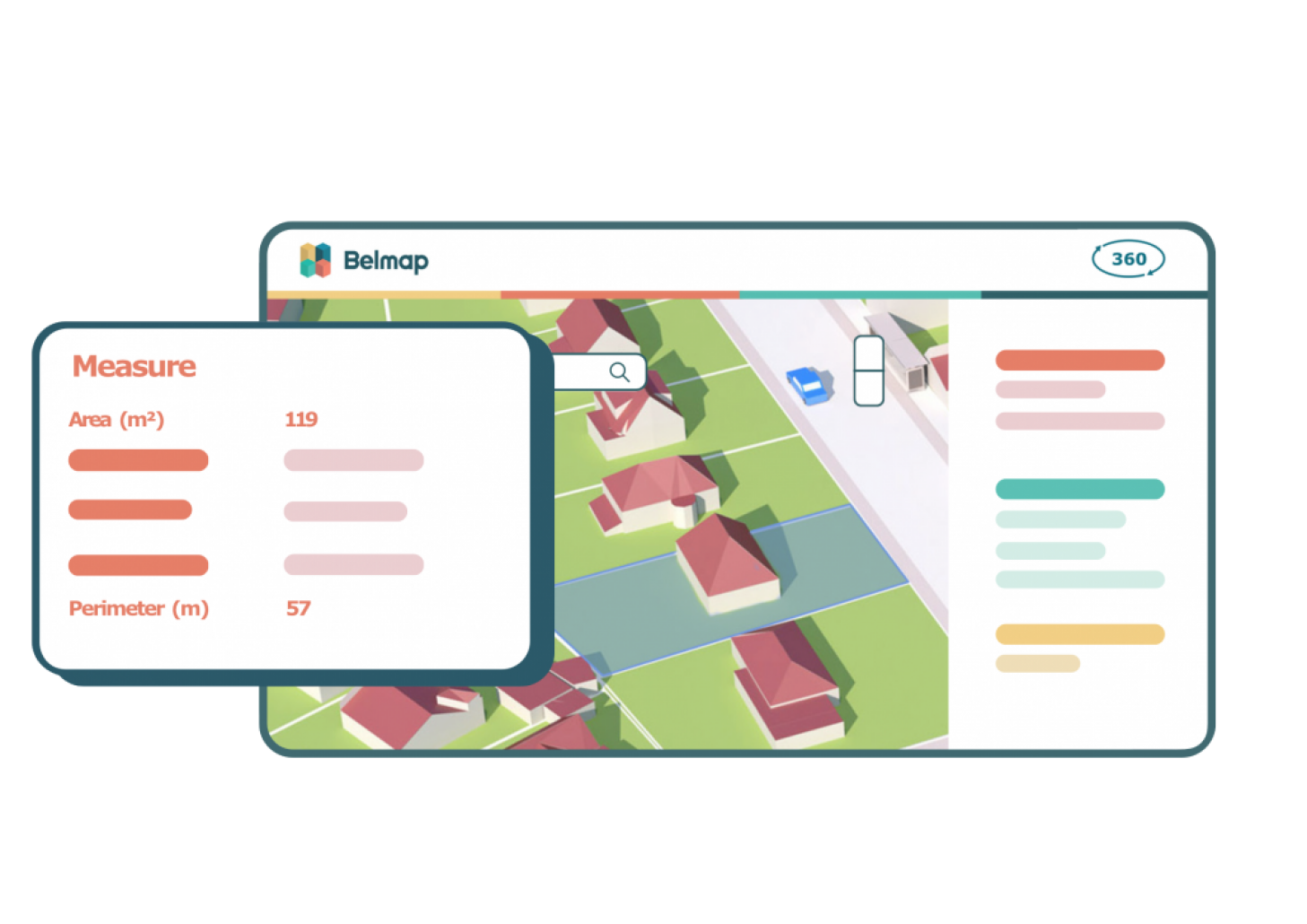
- Measure areas and distances
- View buildings in 2D and 3D
- Street view
- Integrate 3rd party data through APIs

Perform in-depth 360° spatial analysis
Belmap 360 comes standard with a number of advanced data inspection and analysis tools.
- View maps in 2D, 3D or switch to street view.
- Make selections and self-select from a variety of available layers.
- View the properties of an object and analyze its surroundings.

Answer any location question in a flash
Need insights into buildings and addresses? With the Belmap "Query-Me" Service, you'll answer any questions in the blink of an eye.
From the installation of solar panels, to the distribution of your ideal customer profile, to the number of mailboxes on a particular street: formulate your question and the Belmap API will give you the answer in seconds
Gather additional custom insights
Create your own Belmap 360 environment that fits your business needs by removing redundant features or layers.
Need specific information? Thanks to third-party APIs from preferred partners, you can get additional information tailored to your needs.